E4 Hiking Trail Crete
The E4 Hiking Trail in Crete at a Glance

The E4 hiking trail in Crete is the island's section of the European long-distance path E4, crossing Crete from Kissamos (Kastelli) in the west to Kato Zakros in the east. The E4 in Crete passes through the White Mountains (Lefka Ori), Mount Psiloritis (Mount Ida) and the Dikti Mountains. Allow 3 to 4 weeks to hike the whole trail.
The E4 suits everything from gentle walks to very demanding mountain hikes. Most people walk a section or 2 rather than the whole route. We haven't walked the whole E4 in Crete, but we have completed sections of it.
The European E4 Path

The European E4 path is 12,070 km long and runs from Spain to Cyprus, according to the European Ramblers' Association E4 page (checked October 2026). The E4 passes through 10 countries: Spain, France, Switzerland, Germany, Austria, Hungary, Serbia, Bulgaria, Greece and Cyprus.
The European Ramblers' Association (ERA) was founded in 1969 and now has 68 member organisations from 35 countries. In Greece, the Hellenic Federation of Mountaineering and Climbing set up the E4 and looks after it.
The E4 in Crete is waymarked with yellow diamond signs carrying the letters "E4", yellow-and-black striped poles, and yellow-and-black markers on rocks and trees. The EOS Chania E4 route pages show the signs.
Take a good map of Crete if you plan to walk the E4. Place names are spelt in several ways on maps and road signs, which can be confusing. These 4 examples show the usual variations:
- Heraklion, the capital of Crete, also appears as Heraklio, Irakleion, Iraklion or Iraklio.
- Chania, the former capital, also appears as Hania or Xania.
- Agios Nikolaos also appears as Ayios or Aghios Nikolaos, because "G", "Y" and "Gh" are used for the same sound.
- Lasithi also appears as Lassithi, because words with one "s" are often written with two.
Ask the locals if you are unsure of the way.
Sections of the E4 Hiking Trail in Crete
The E4 in Crete varies from walking on quiet asphalt roads to rough hiking through gorges and real mountain trekking. Some parts are overgrown, hard to follow or not marked at all.
In Chania, the E4 runs from Kissamos via Chrysoskalitissa, Elafonisi and Paleochora to Sougia, a small resort on the south coast. At Sougia the trail forks into 2 main routes, according to the EOS Chania route pages:
- The coastal route follows the very rough shore path via Tripiti to Agia Roumeli, then continues along the coast to Frangokastello.
- The mountain route climbs to the Omalos Plateau, either through the Agia Irini Gorge or via Koustogerako, and its high-mountain stage crosses the White Mountains via the Kallergi and Svourichti huts to Tavri and the Askyfou Plateau.
The 2 routes meet again on the south coast near Frangokastello, then split again into a northern branch and an alpine branch over the high mountains. They join once more for the common eastern stages to Kato Zakros. The European Ramblers' Association warns that the stretch from Lykos beach to Marmara beach is very poorly marked and hardly secured.

Mountain Refuge Huts on the E4
Walkers on the alpine branch of the E4 need to arrange any stay in a mountain refuge hut in advance. The mountaineering clubs of Chania, Rethymno, Heraklion and Lasithi maintain the huts, and our guide to the mountains and gorges of Crete lists them.
Highlights Along the E4 in Crete
The E4 in Crete passes mountains, gorges, south coast villages and Minoan ruins. These places are among the highlights on or near the route:
- Agia Roumeli: a coastal village at the foot of the Samaria Gorge, reached only on foot or by boat.
- Loutro: a whitewashed village on the south coast, also reached only on foot or by boat.
- Sweetwater Beach: a pebble beach near Loutro on the coastal stretch to Chora Sfakion.
- Aradena: a nearly abandoned village above a dramatic gorge.
- The Omalos Plateau: a high plain in the White Mountains, with views of the peaks and wild flowers in spring.
- Anogia: a mountain village on the slopes of Psiloritis, known for its history, music and weaving.
- Kato Zakros: the eastern end of the trail, with the ruins of the Minoan palace of Zakros.
Our guides to Anogia, the mountain village on the E4, and to Zakros at the end of the trail cover 2 of these places in more detail.
When to Walk the E4 Trail in Crete
Spring (March to May) and autumn (September to early November) are the most comfortable seasons for walking the E4 in Crete. Each season suits the trail differently:
- Spring: wild flowers cover the hills, the weather is mild and wildlife is easy to spot.
- Autumn: the days are cooler, the paths are quieter and the sea is still warm enough for a swim after a walk.
- Summer: July and August are very hot, so start early, choose shaded routes and carry plenty of water.
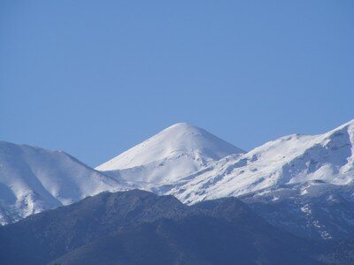
- Winter: December to February suits the lower and coastal paths, while the high sections, such as the White Mountains, can be snowbound or impassable.
Preparing for the E4 Trail and Staying Safe
To prepare for the E4 in Crete, choose sections that match your fitness, plan your overnight stops and pack for heat and rough ground. Beginners can start with the gentler coastal sections, while experienced hikers can tackle the high White Mountains.
These items belong in every day pack on the trail:
- Sturdy hiking boots with good grip.
- Light clothing suited to the season.
- A hat, sunscreen and sunglasses.
- Plenty of water and snacks.
- A first aid kit and a fully charged phone or GPS device.
These 4 safety rules apply on every section:
- Check the weather forecast before setting out, especially for the mountain routes.
- Tell someone your route and when you expect to return.
- Stay on marked paths, and use a map or GPS to avoid getting lost.
- Plan your overnight stops in advance, because villages are far apart on some stretches.
Villages along the route have guesthouses and rooms. Loutro, Chora Sfakion and Anogia make good places to rest between sections, and the trail-side tavernas serve dishes such as dakos and homemade cheese pies.
After a few days on the trail, many walkers spend time by the sea. Our guide to the Best Crete Beaches suggests where to go.
Want to discover even more of what Crete has to offer?
Explore hidden gems, must-visit spots, and insider tips below!